To develop, using the iMagine platform, a prototype service for processing video images from beach cameras for monitoring formation and dismantling events of seagrass beach berms (Posidonia oceanica) and detecting rip-currents.
Prototype
Beach Monitoring
Posidonia oceanica berms and rip-currents detection from beach monitoring systems
Aim
Development actions during iMagine
1
Setting up a development and training environment at the iMagine platform
2
Connecting the existing database to the iMagine platform for ingesting and extracting data
3
Analysis and training of AI models fit for processing daily images of seagrass berms. Focus of AI will be on quantification of berms area in time and analysis of events of formation and dismantling
4
Analysis and training of AI models fit for detecting rip currents, their position, and characteristics (length, wide)
5
Documenting approach and experiences with resulting prototype
6
Contributing to dissemination and outreach
Objective and challenge
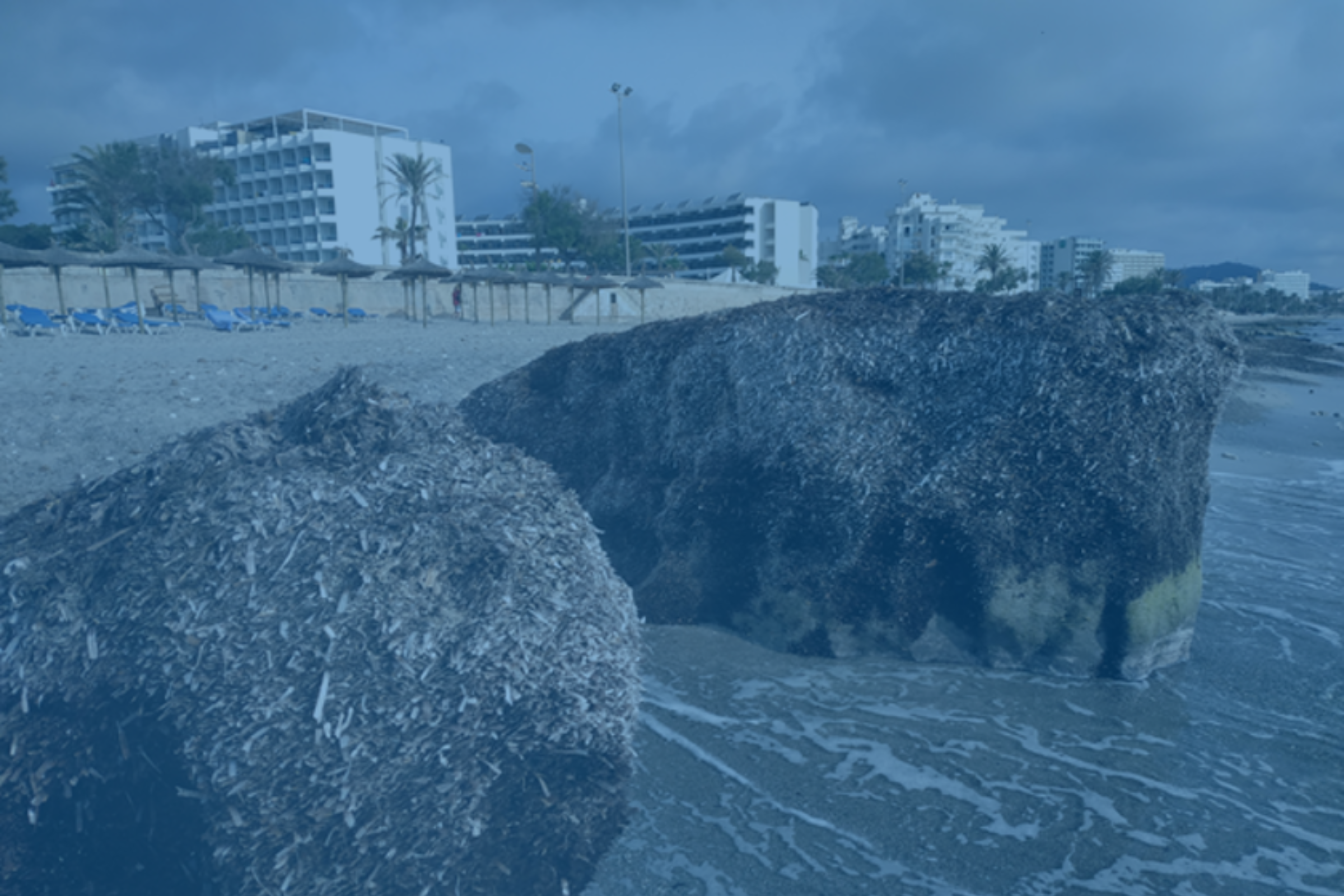
Since 2011, SOCIB has been conducting systematic and continuous monitoring of beaches using cameras, generating valuable long-term time-series data. This data is accessible to scientists, coastal management authorities, and citizens, and is currently utilized for shoreline tracking. In the iMagine project, we aim to develop a prototype service that processes video images from beach cameras to monitor the formation and dismantling of seagrass beach berms (Posidonia oceanica) and detect rip currents.
Analyzing the existing system, we identified gaps and bottlenecks. Currently, the shoreline position is manually extracted from the SIRENA video-monitoring system at infrequent intervals (~15 days), even though images are captured multiple times per day. No other beach features are extracted, despite the potential to obtain valuable information about biogeophysical and socioeconomic processes, such as identifying Posidonia berms, rip currents, determining beach width, swash zone, and run-up. By utilizing Deep Learning (DL) techniques for image segmentation, we can automatically extract information on important features like sand, water, white scum, Posidonia berms, humans, and vessels. This automation would allow for shoreline extraction at almost all available timestamps and characterization of Posidonia berms, among other essential aspects of beach monitoring and management. Additionally, DL applied to object identification could aid in the identification of rip currents, which is crucial for emergency services, forecasting models, and early-warning systems.
Expected Results
1
Seagrass is an important indicator for ocean health. The detection of Posidonia oceanica berms formation and dismantling events will add to characterising and understanding seagrass berms variability and underlying processes and provide more insights in their role as wave damping areas in front of extreme wave events. Rip-currents are narrow, offshore directed currents that represent one of the greatest hazards for beach users around the world.
2
Therefore, detection of Rip-currents will contribute to developing a real-time warning system for beach recreation. Furthermore, their characterization will help to gain knowledge on sediment transport processes and beach erosion/accretion patterns related to rip-currents. The iMagine prototype service including beach camera’s has great potential for application at other beaches all over Europe.
